- Display 24 Products per page
-
 11oz From $14.21 15oz From $16.46
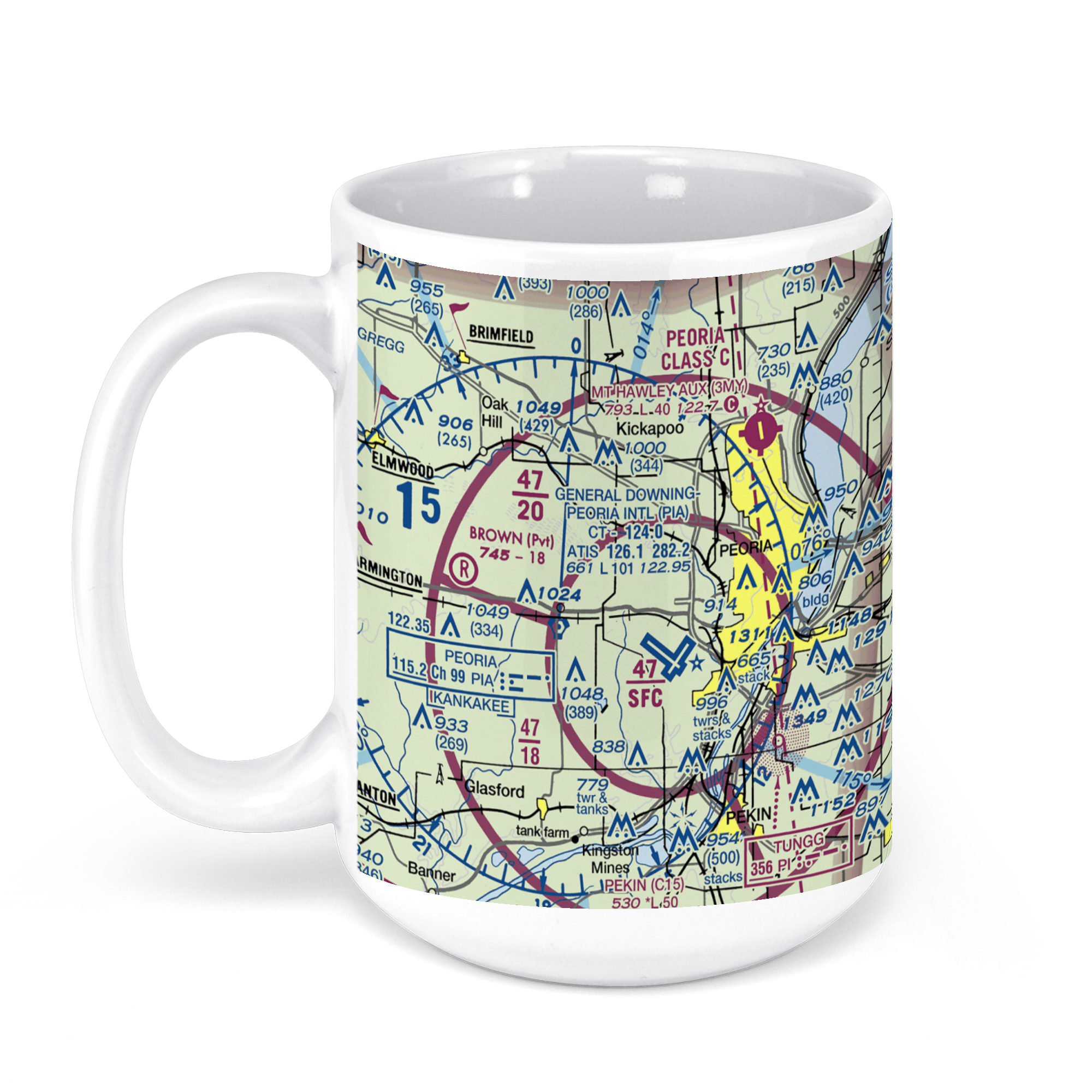
General Wayne A. Downing Peoria International Airport, Everett McKinley Dirksen Parkway, Peoria, IL, USA FAA Sectional Aeronautical Charts Chart Mug
From: $18.95MIX, MATCH & SAVE! UP TO 25% OFFDistance from your search: 1673.5mi -
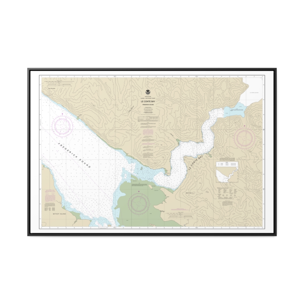
Le Conte Bay Nautical Chart 17377 – Floating Frame Canvas
From: $164.95PREMIUM FLOATING FRAME CANVASDistance from your search: 1673.8mi -
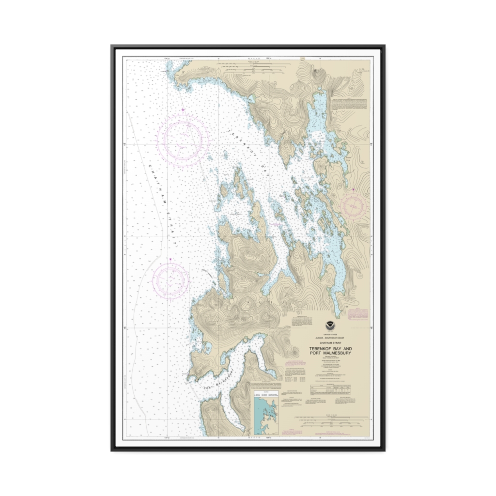
Tebenkof Bay and Port Malmesbury Nautical Chart 17376 – Floating Frame Canvas
From: $164.95PREMIUM FLOATING FRAME CANVASDistance from your search: 1677mi -
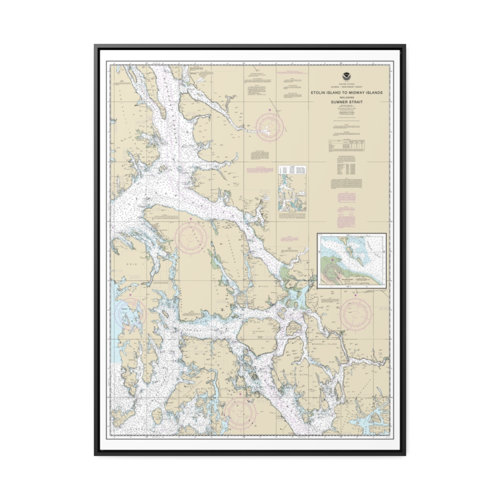
Etolin Island to Midway Islands, including Sumner Strait Holkham Bay Big Castle Island Nautical Chart 17360 – Floating Frame Canvas
From: $184.95PREMIUM FLOATING FRAME CANVASDistance from your search: 1677.6mi -
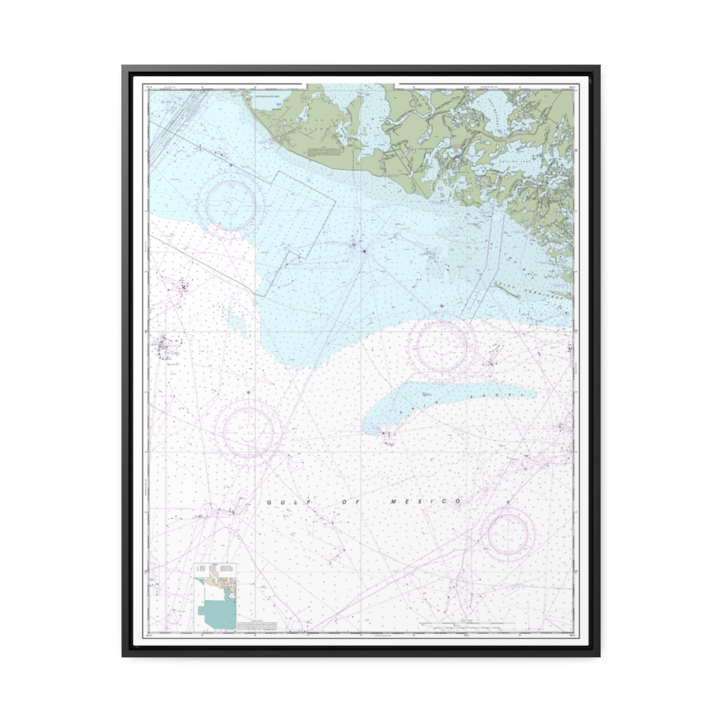
Isles Dernieres to Point au Fer Nautical Chart 11356 – Floating Frame Canvas
From: $184.95PREMIUM FLOATING FRAME CANVASDistance from your search: 1679.6mi -
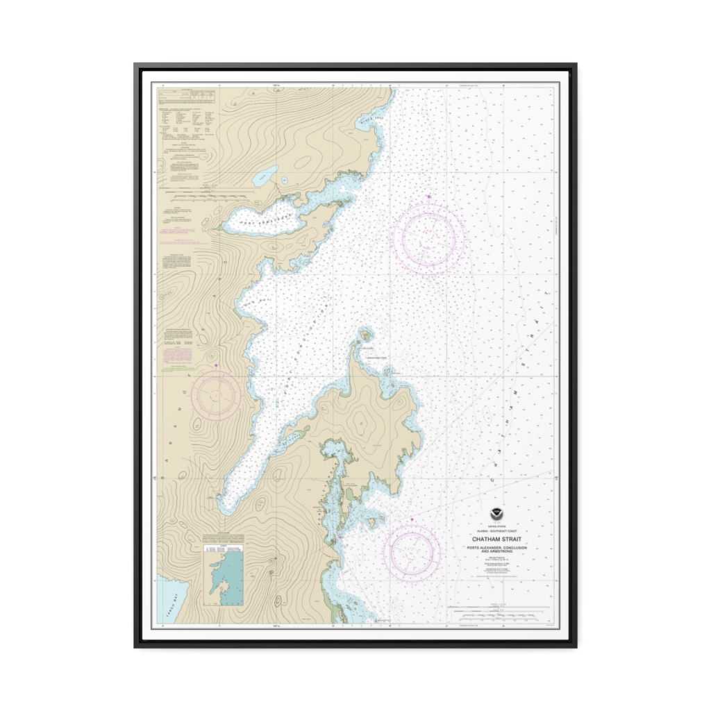
Chatham Strait Ports Alexander, Conclusion, and Armstrong Nautical Chart 17331 – Floating Frame Canvas
From: $184.95PREMIUM FLOATING FRAME CANVASDistance from your search: 1682.7mi -
 11oz From $14.21 15oz From $16.46
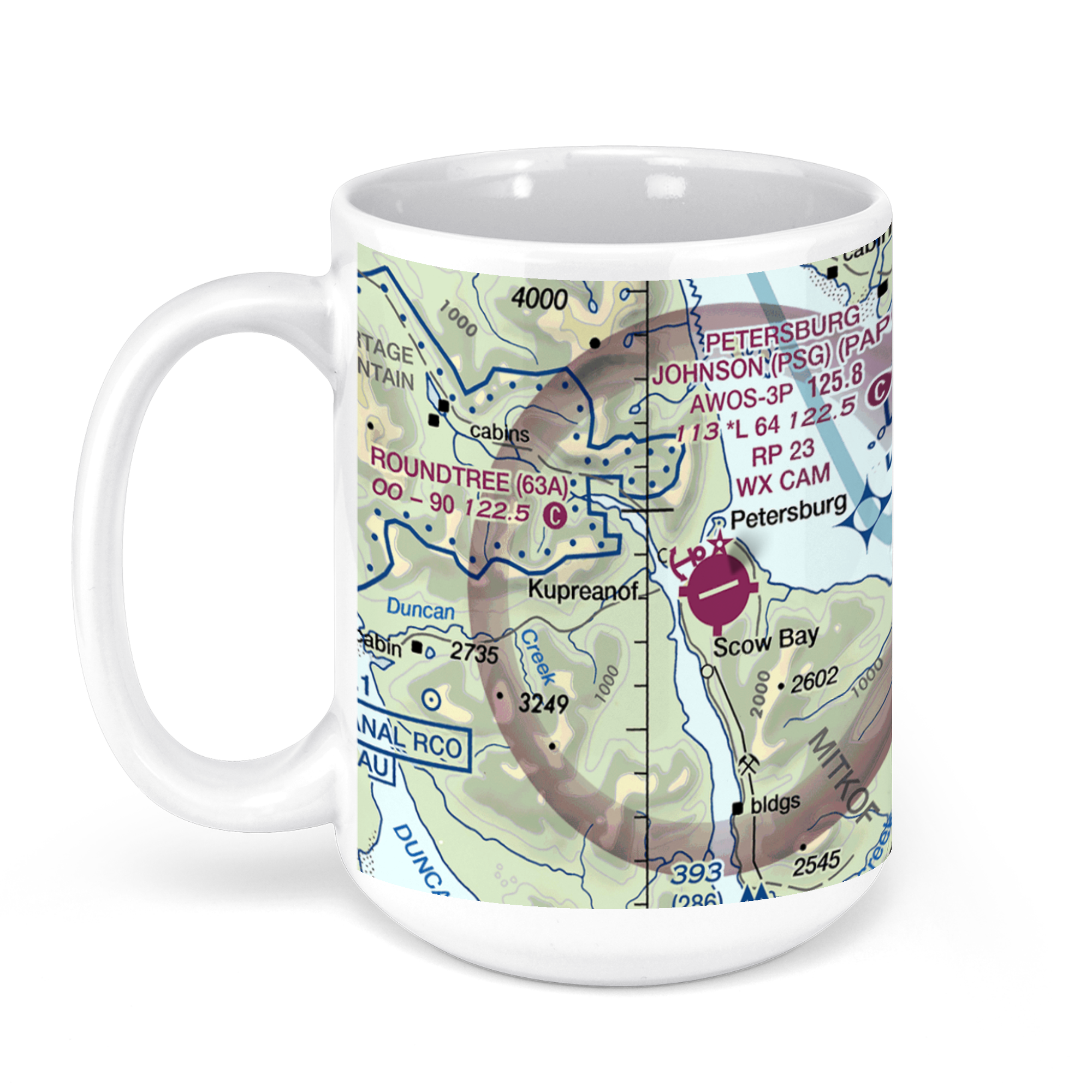
Petersburg James a Johnson, Haugen Drive, Petersburg, AK, USA FAA Sectional Aeronautical Charts Chart Mug
From: $18.95MIX, MATCH & SAVE! UP TO 25% OFFDistance from your search: 1683.4mi -
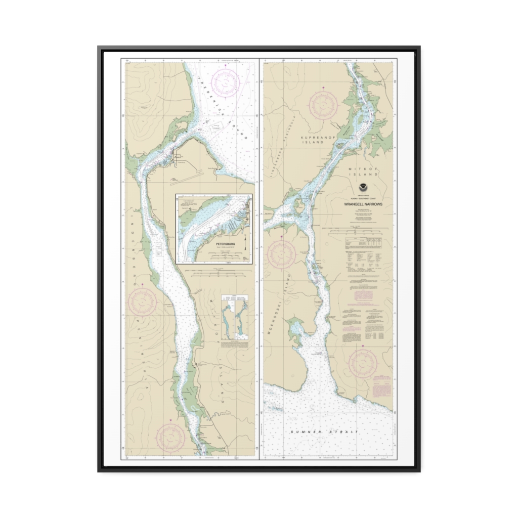
Wrangell Narrows Petersburg Harbor Nautical Chart 17375 – Floating Frame Canvas
From: $184.95PREMIUM FLOATING FRAME CANVASDistance from your search: 1684.1mi -
 11oz From $14.21 15oz From $16.46
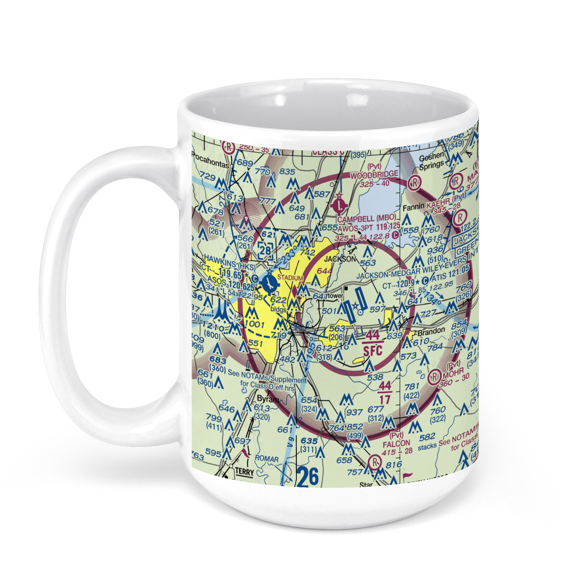
Jackson-Evers International Airport (JAN), International Drive, Jackson, MS, USA FAA Sectional Aeronautical Charts Chart Mug
From: $18.95MIX, MATCH & SAVE! UP TO 25% OFFDistance from your search: 1687.2mi -
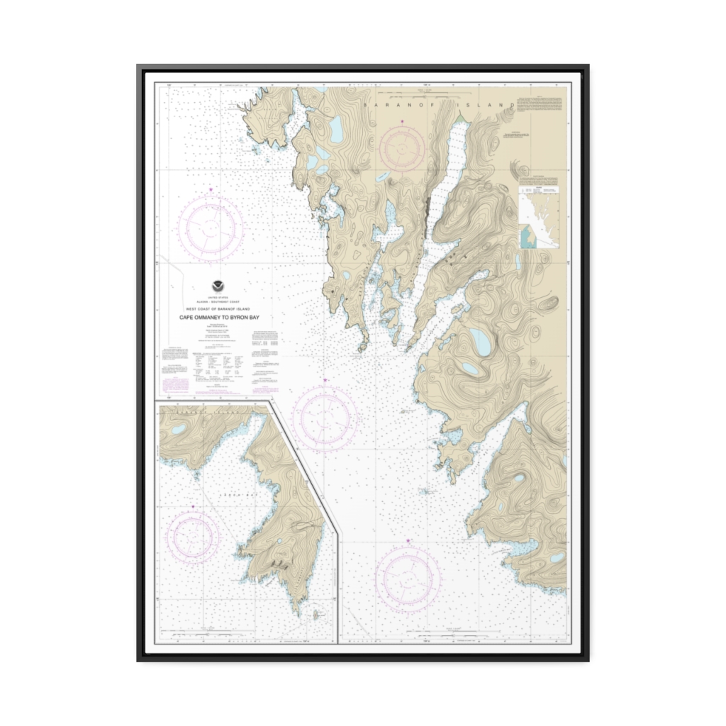
West Coast of Baranof Island Cape Ommaney to Byron Bay Nautical Chart 17330 – Floating Frame Canvas
From: $184.95PREMIUM FLOATING FRAME CANVASDistance from your search: 1687.3mi -
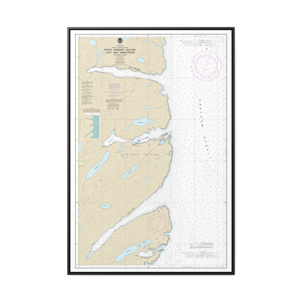
Ports Herbert, Walter, Lucy and Armstrong Nautical Chart 17333 – Floating Frame Canvas
From: $164.95PREMIUM FLOATING FRAME CANVASDistance from your search: 1687.3mi -
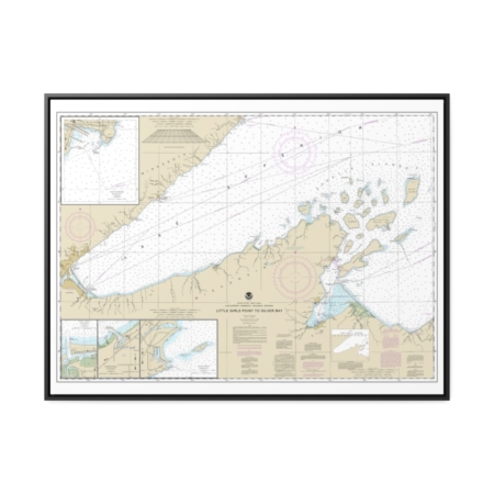
Little Girls Point to Silver Bay, including Duluth and Apostle Islands Cornucopia Harbor Port Wing Harbor Knife River Harbor Two Harbors Nautical Chart 14966 – Floating Frame Canvas
From: $184.95PREMIUM FLOATING FRAME CANVASDistance from your search: 1688mi -
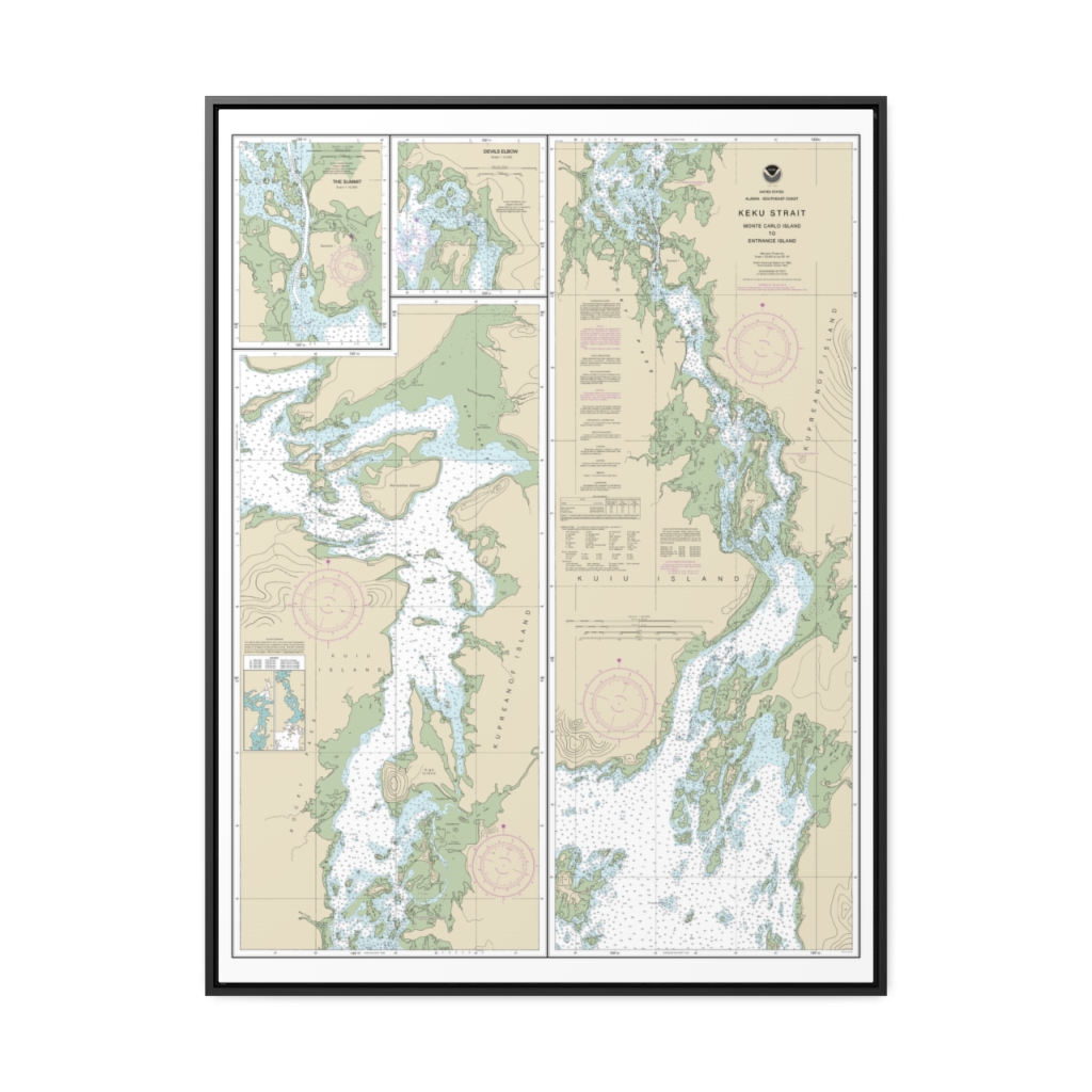
Keku Strait-Monte Carlo Island to Entrance Island The Summit Devils Elbow Nautical Chart 17372 – Floating Frame Canvas
From: $184.95PREMIUM FLOATING FRAME CANVASDistance from your search: 1689.8mi -
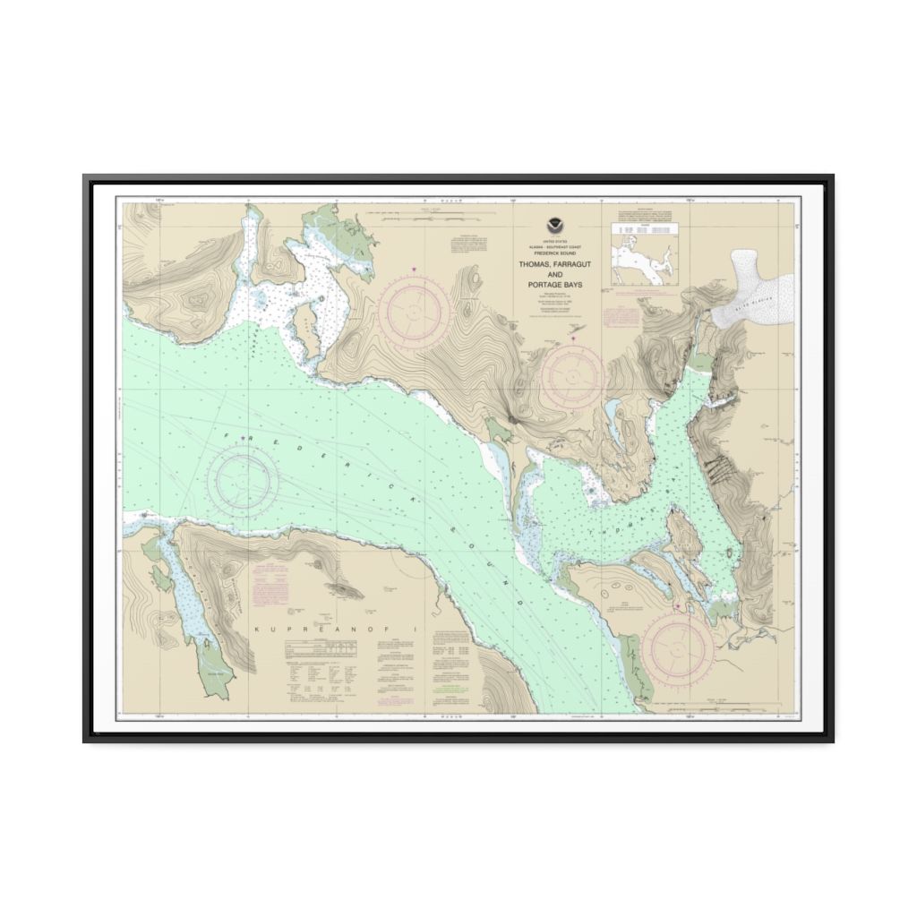
Thomas, Farragut, and Portage Bays, Frederick Sound Nautical Chart 17367 – Floating Frame Canvas
From: $184.95PREMIUM FLOATING FRAME CANVASDistance from your search: 1697.9mi -
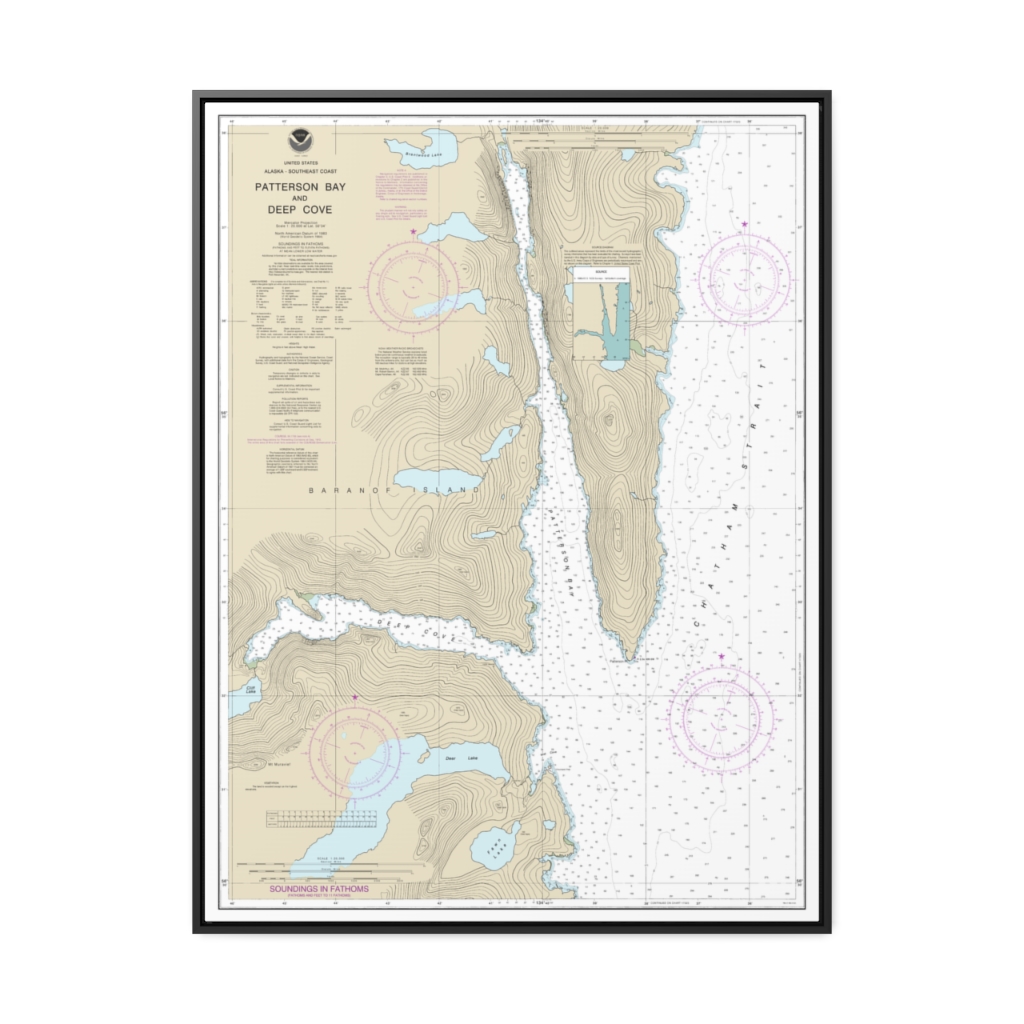
Patterson Bay and Deep Cove Nautical Chart 17335 – Floating Frame Canvas
From: $184.95PREMIUM FLOATING FRAME CANVASDistance from your search: 1699.9mi -
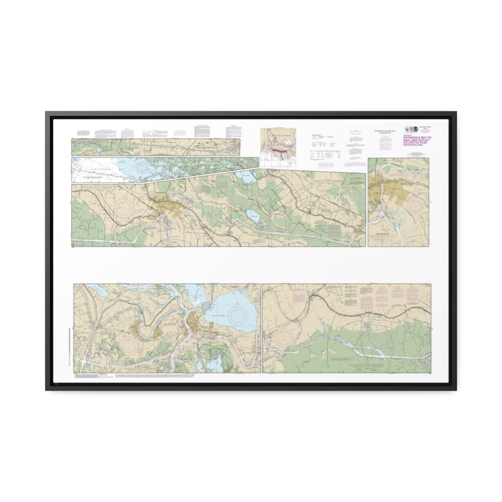
Intracoastal Waterway Catahoula Bay to Wax Lake Outlet including the Houma Navigation canal Nautical Chart 11355 – Floating Frame Canvas
From: $164.95PREMIUM FLOATING FRAME CANVASDistance from your search: 1700.9mi -
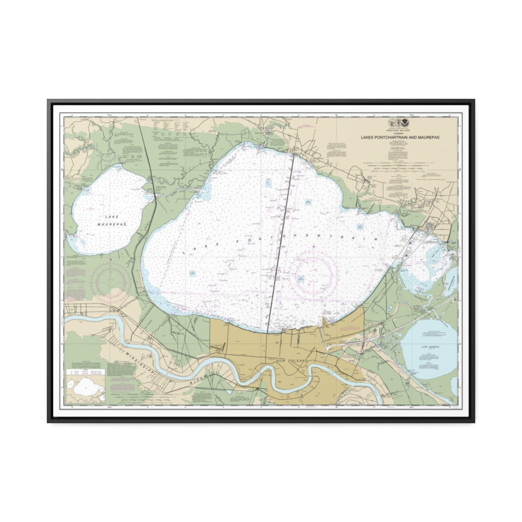
Lakes Pontchartrain and Maurepas Nautical Chart 11369 – Floating Frame Canvas
From: $184.95PREMIUM FLOATING FRAME CANVASDistance from your search: 1701.4mi -
 11oz From $14.21 15oz From $16.46
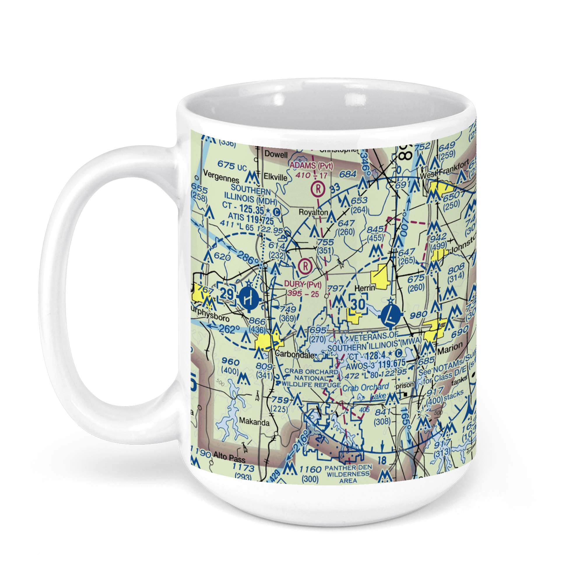
Williamson County Regional Airport, Terminal Drive, Marion, IL, USA FAA Sectional Aeronautical Charts Chart Mug
From: $18.95MIX, MATCH & SAVE! UP TO 25% OFFDistance from your search: 1701.9mi -
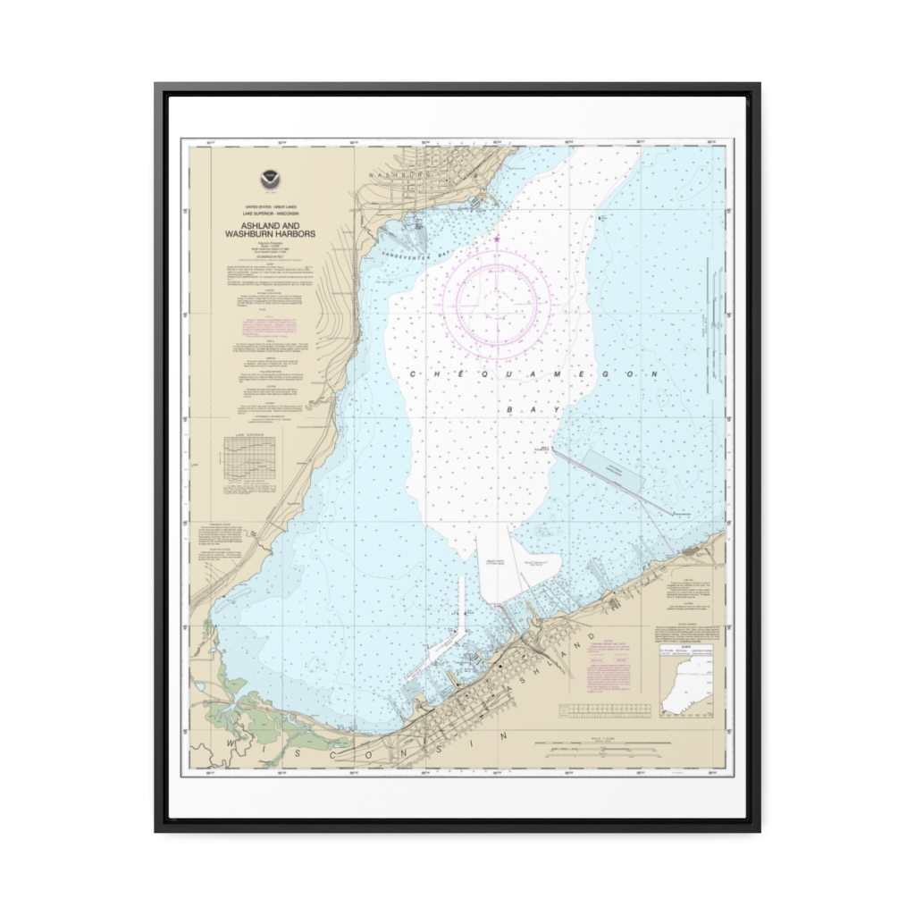
Ashland and Washburn harbors Nautical Chart 14974 – Floating Frame Canvas
From: $184.95PREMIUM FLOATING FRAME CANVASDistance from your search: 1702.2mi -
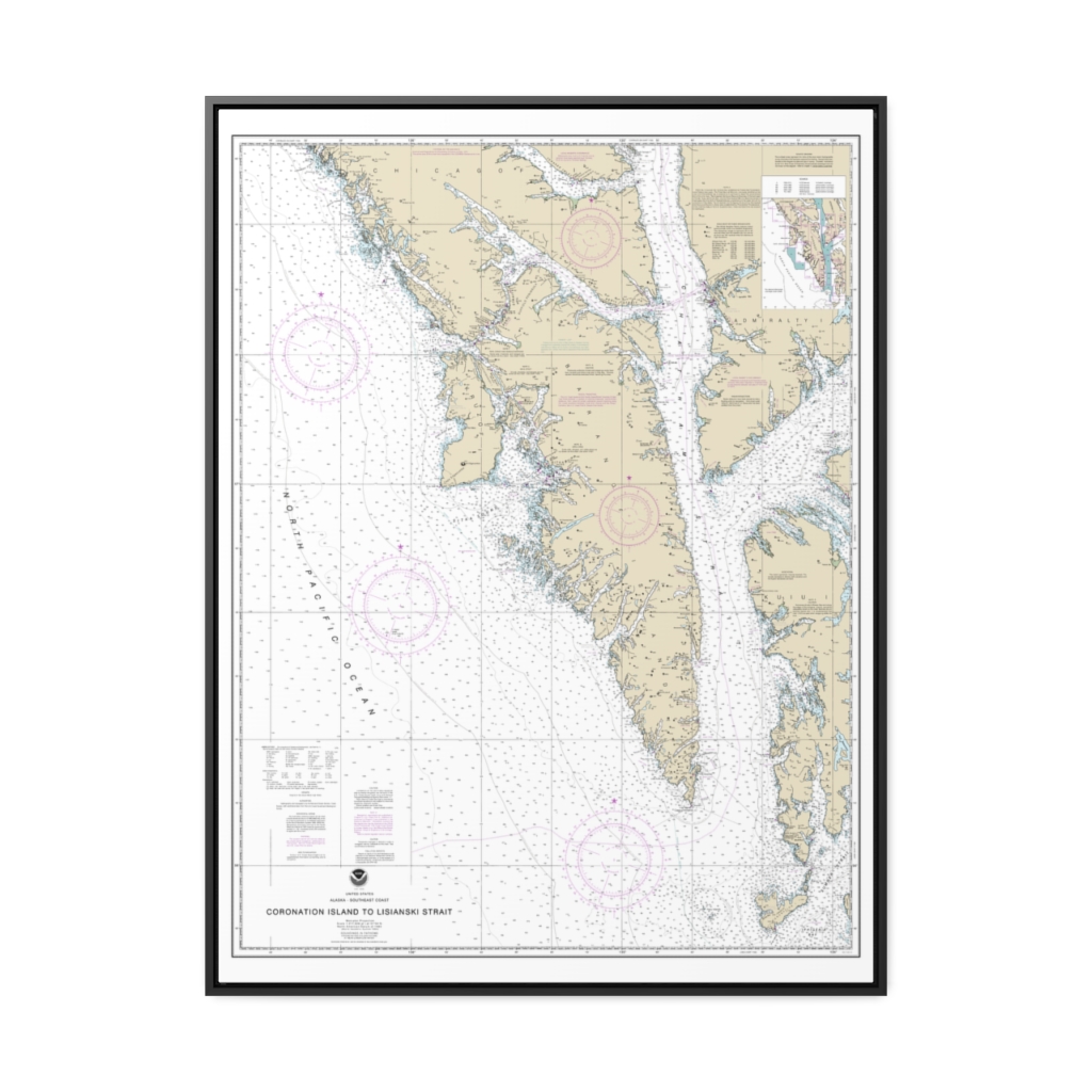
Coronation Island to Lisianski Strait Nautical Chart 17320 – Floating Frame Canvas
From: $184.95PREMIUM FLOATING FRAME CANVASDistance from your search: 1703.2mi -
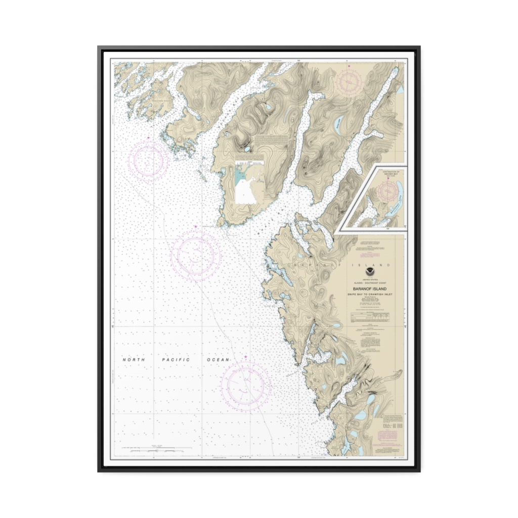
Snipe Bay to Crawfish Inlet,Baranof l. Nautical Chart 17328 – Floating Frame Canvas
From: $184.95PREMIUM FLOATING FRAME CANVASDistance from your search: 1704.1mi -
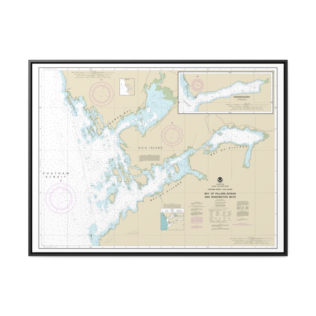
Bay of Pillars and Rowan Bay, Chatham Strait Washington Bay, Chatham Strait Nautical Chart 17370 – Floating Frame Canvas
From: $184.95PREMIUM FLOATING FRAME CANVASDistance from your search: 1705.3mi -
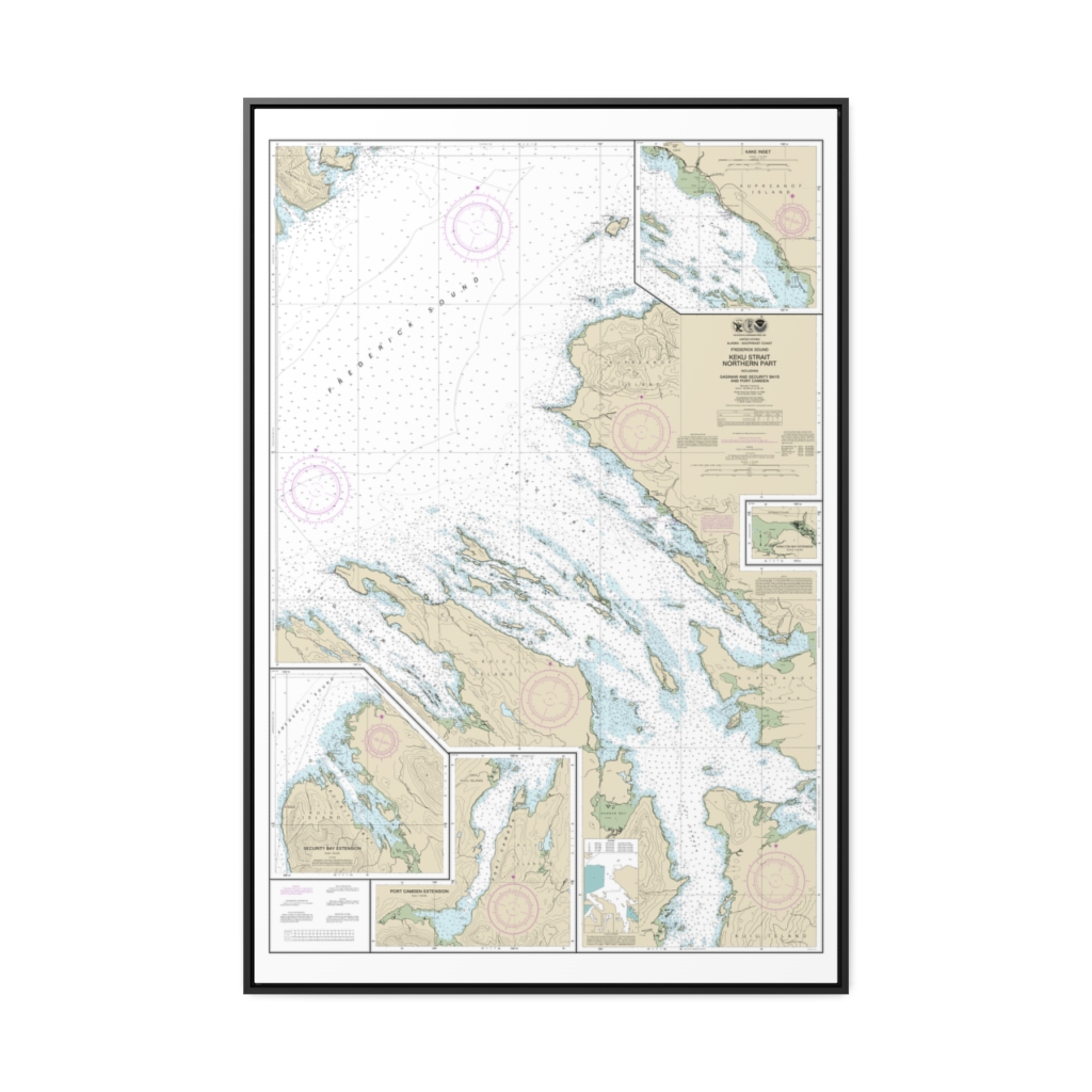
Keku Strait-northern part, including Saginaw and Security Bays and Port Camden;Kake Inset Nautical Chart 17368 – Floating Frame Canvas
From: $164.95PREMIUM FLOATING FRAME CANVASDistance from your search: 1710.3mi -
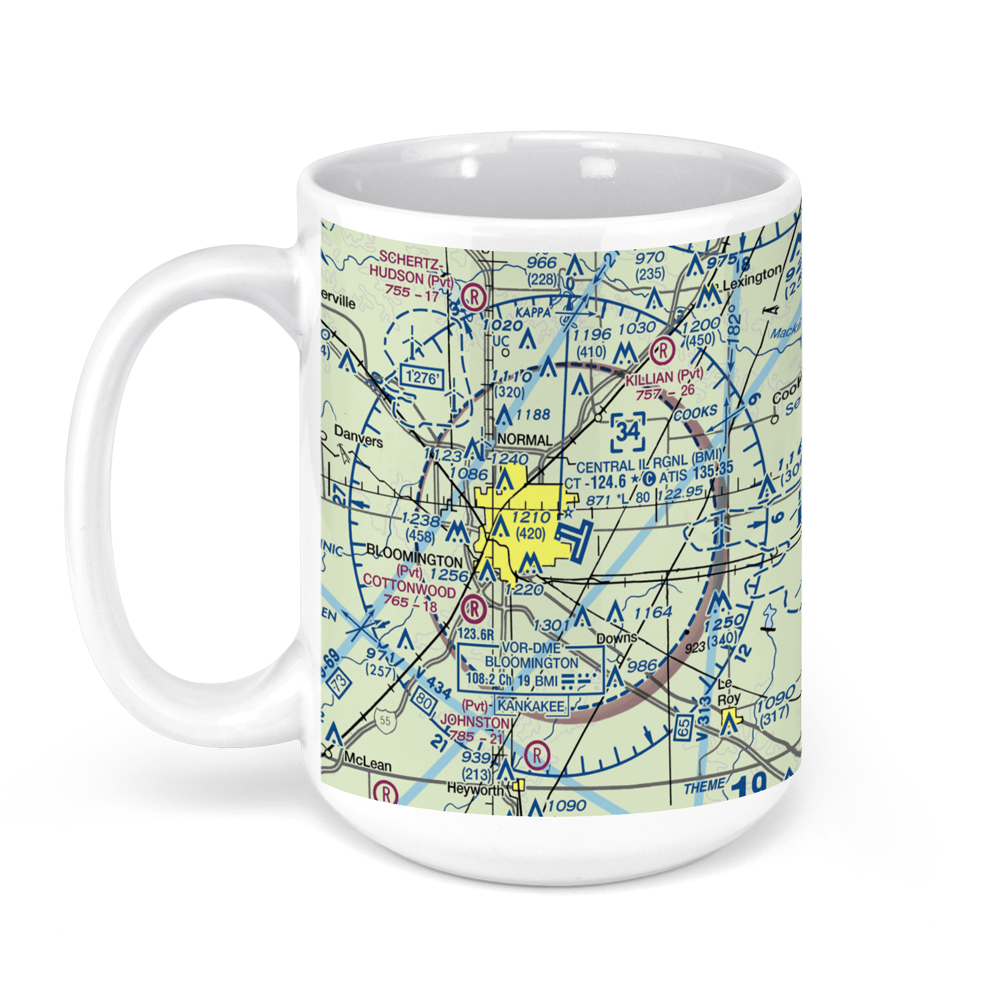 11oz From $14.21 15oz From $16.46
Central Illinois Regional Airport at Bloomington-Normal (BMI), Cira Drive, Bloomington, IL, USA FAA Sectional Aeronautical Charts Chart Mug
From: $18.95MIX, MATCH & SAVE! UP TO 25% OFFDistance from your search: 1712.7mi


