- Display 24 Products per page
-
 11oz From $14.21 15oz From $16.46
Nauset Beach North Chatham, Chatham, MA, USA NOAA Nautical Charts Chart Mug
From: $18.95MIX, MATCH & SAVE! UP TO 25% OFFDistance from your search: 3520.1mi -
Distance from your search: 3520.8mi
-
 11oz From $14.21 15oz From $16.46
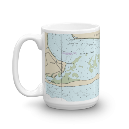
South Beach Katama Bay Chart Mug
From: $18.95MIX, MATCH & SAVE! UP TO 25% OFFDistance from your search: 3520.9mi -
Distance from your search: 3521mi
-
 11oz From $14.21 15oz From $16.46
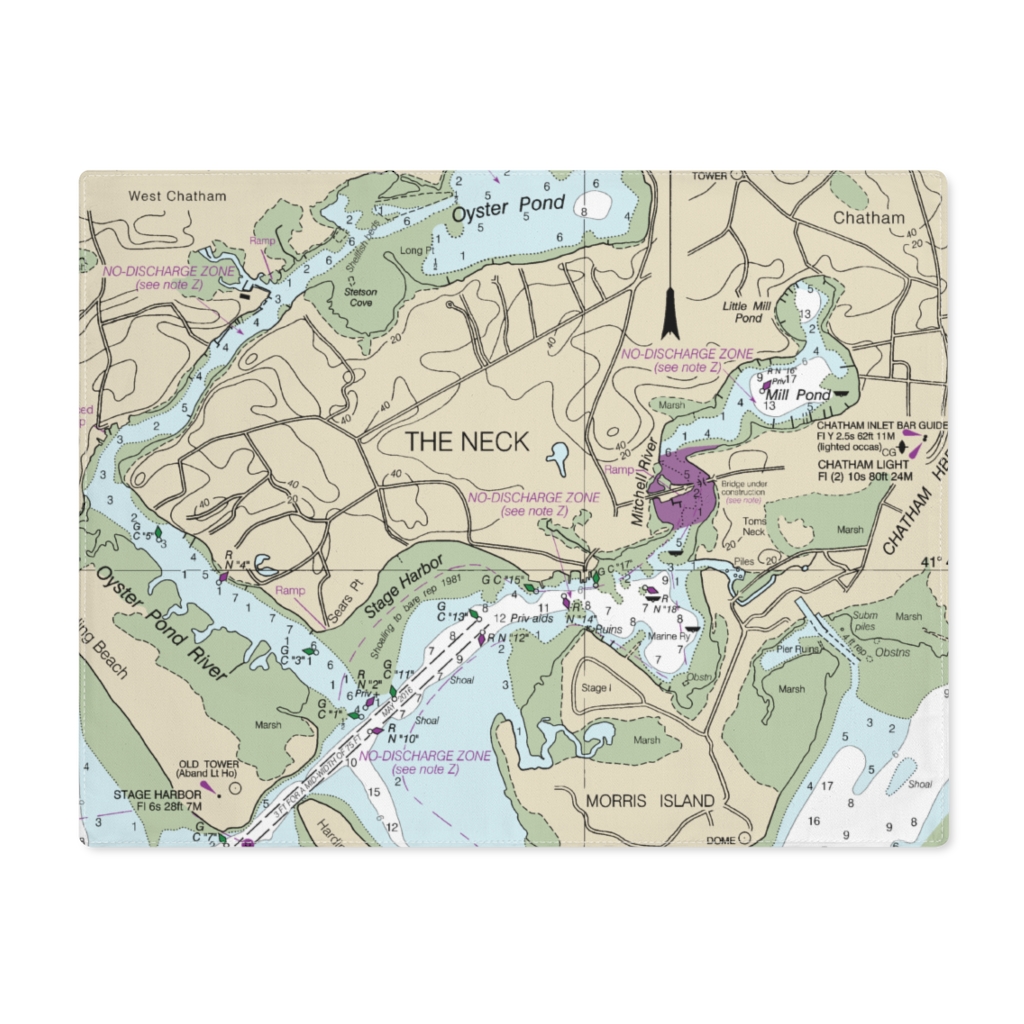
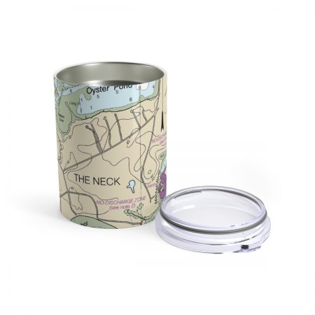
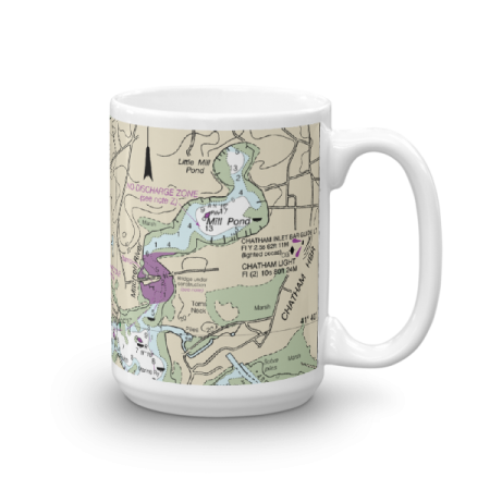
Stage Harbor, Mill Pond Chart Mug
From: $18.95MIX, MATCH & SAVE! UP TO 25% OFFDistance from your search: 3521.6mi -
Distance from your search: 3521.7mi
-
Distance from your search: 3521.7mi
-
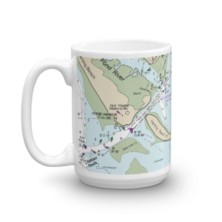 11oz From $14.21 15oz From $16.46
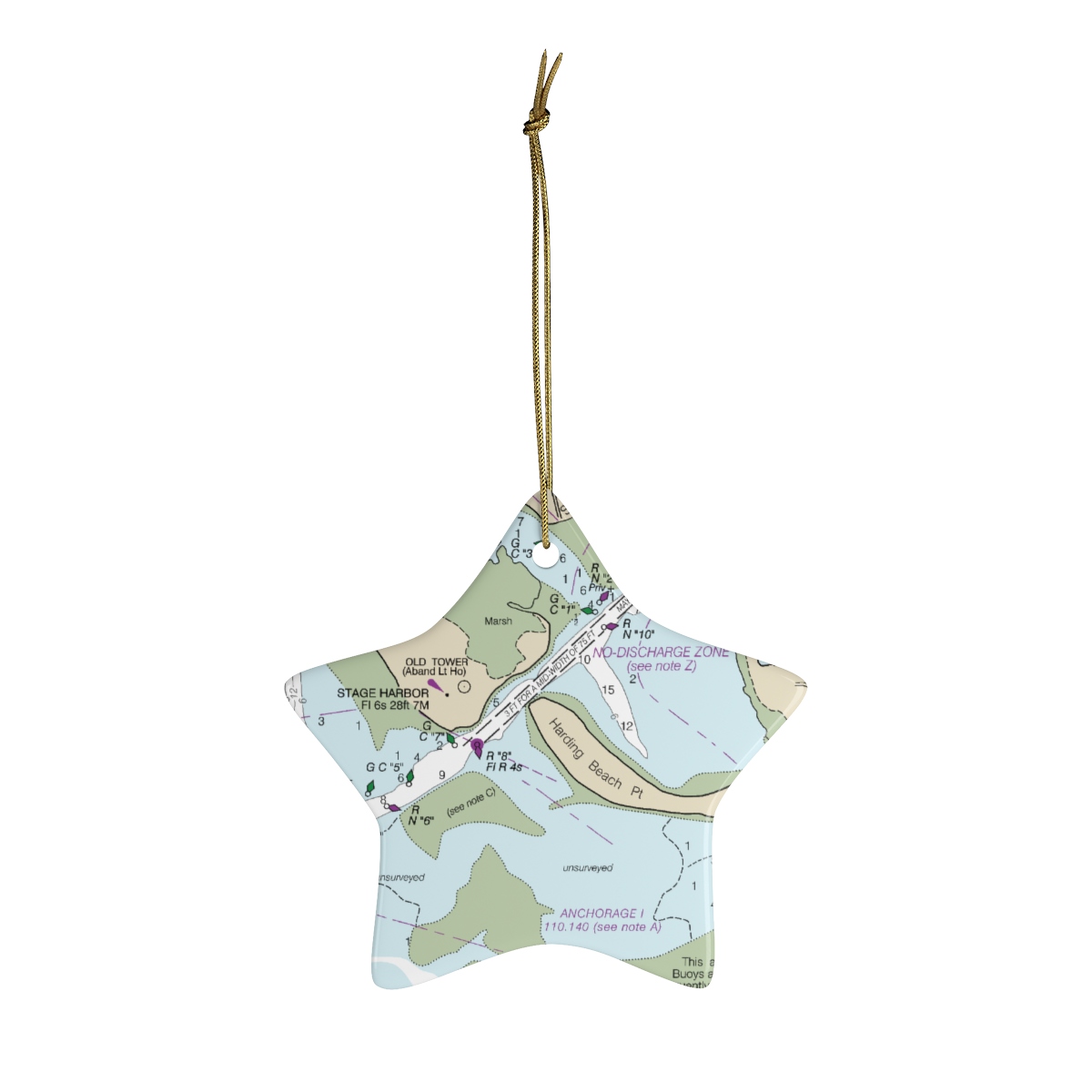
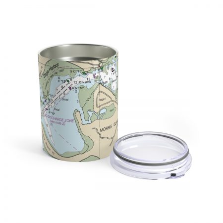
Stage Harbor Chart Mug
From: $18.95MIX, MATCH & SAVE! UP TO 25% OFFDistance from your search: 3521.7mi -
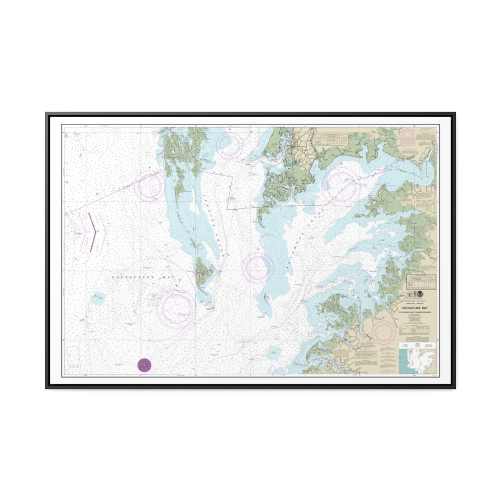
Chesapeake Bay Pocomoke and Tangier Sounds Nautical Chart 12228 – Floating Frame Canvas
From: $164.95PREMIUM FLOATING FRAME CANVASDistance from your search: 3521.9mi -
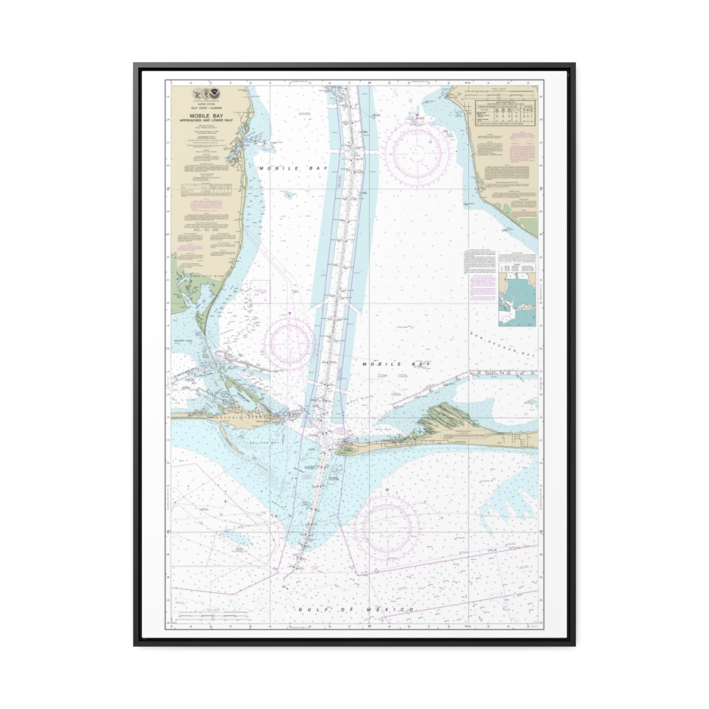
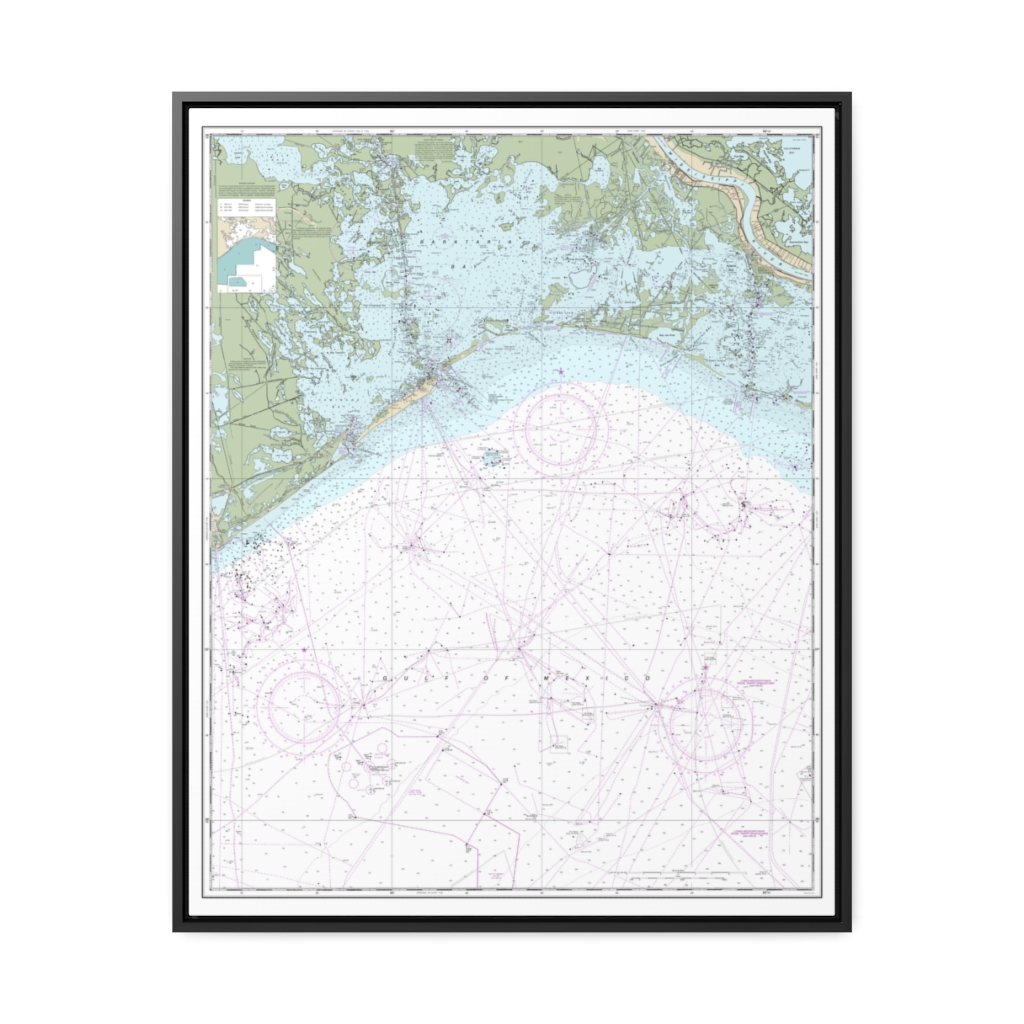
Mobile Bay Approaches and Lower Half Nautical Chart 11377 – Floating Frame Canvas
From: $184.95PREMIUM FLOATING FRAME CANVASDistance from your search: 3523.6mi -
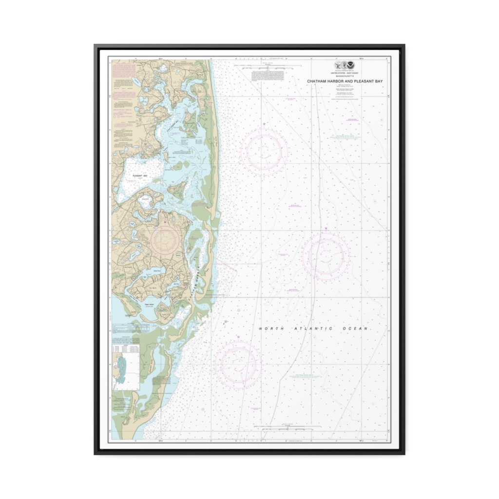
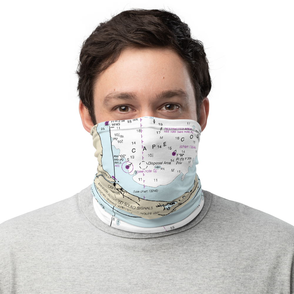
Chatham Harbor and Pleasant Bay Nautical Chart 13248 – Floating Frame Canvas
From: $184.95PREMIUM FLOATING FRAME CANVASDistance from your search: 3524.3mi -
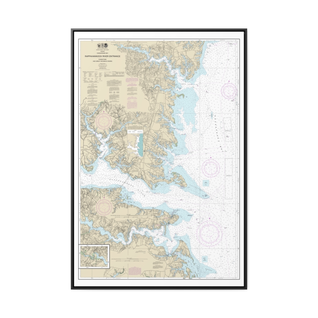
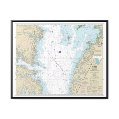
Chesapeake Bay Rappahannock River Entrance, Piankatank and Great Wicomico Rivers Nautical Chart 12235 – Floating Frame Canvas
From: $164.95PREMIUM FLOATING FRAME CANVASDistance from your search: 3524.7mi -
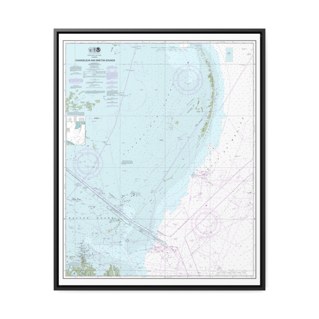
Chandeleur and Breton Sounds Nautical Chart 11363 – Floating Frame Canvas
From: $184.95PREMIUM FLOATING FRAME CANVASDistance from your search: 3526.2mi -
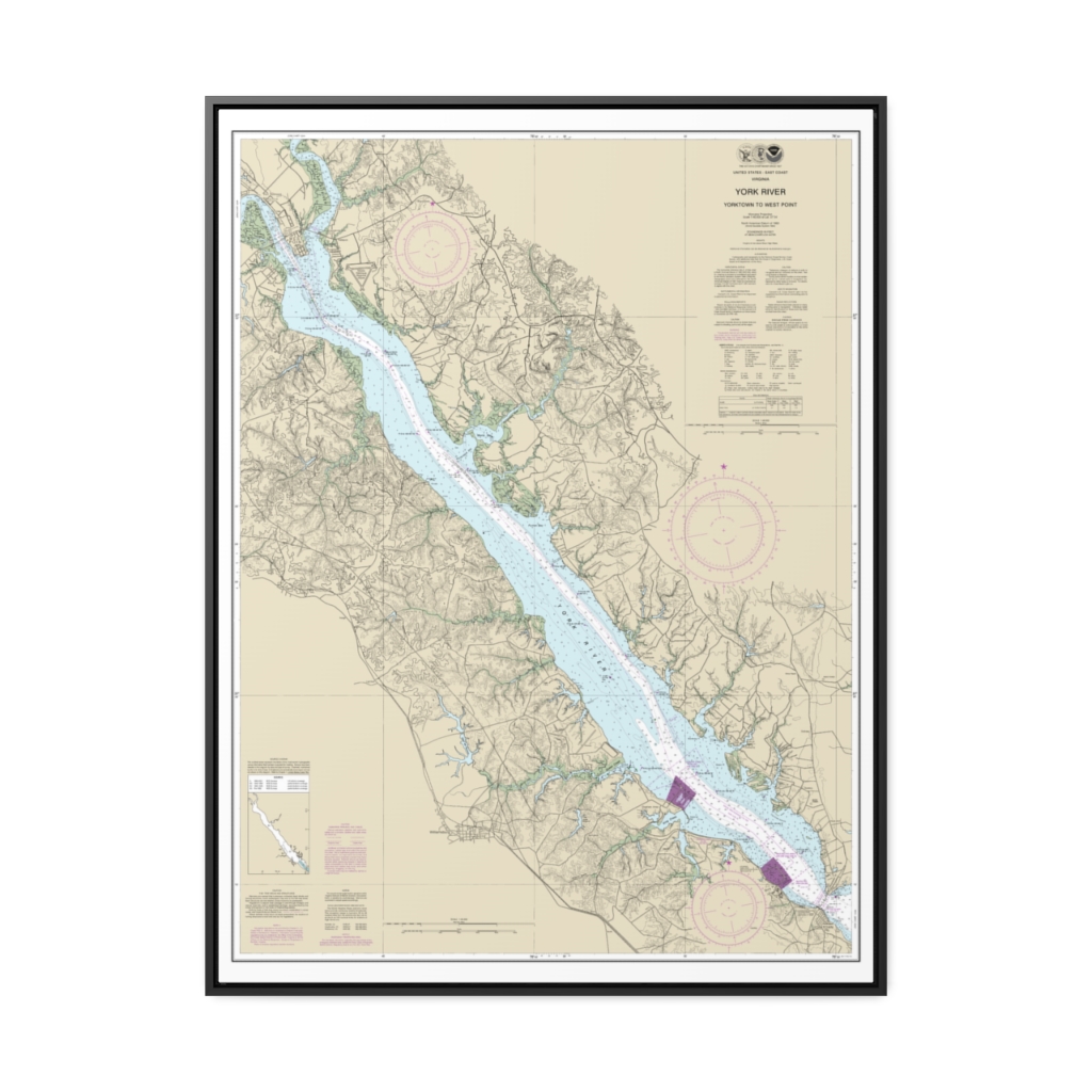
York River Yorktown to West Point Nautical Chart 12243 – Floating Frame Canvas
From: $184.95PREMIUM FLOATING FRAME CANVASDistance from your search: 3526.4mi -
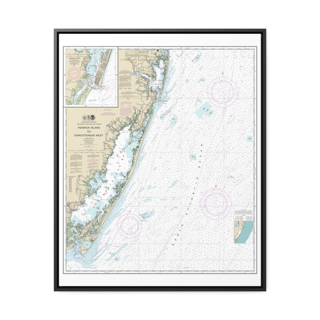
Fenwick Island to Chincoteague Inlet;Ocean City Inlet Nautical Chart 12211 – Floating Frame Canvas
From: $184.95PREMIUM FLOATING FRAME CANVASDistance from your search: 3526.5mi -
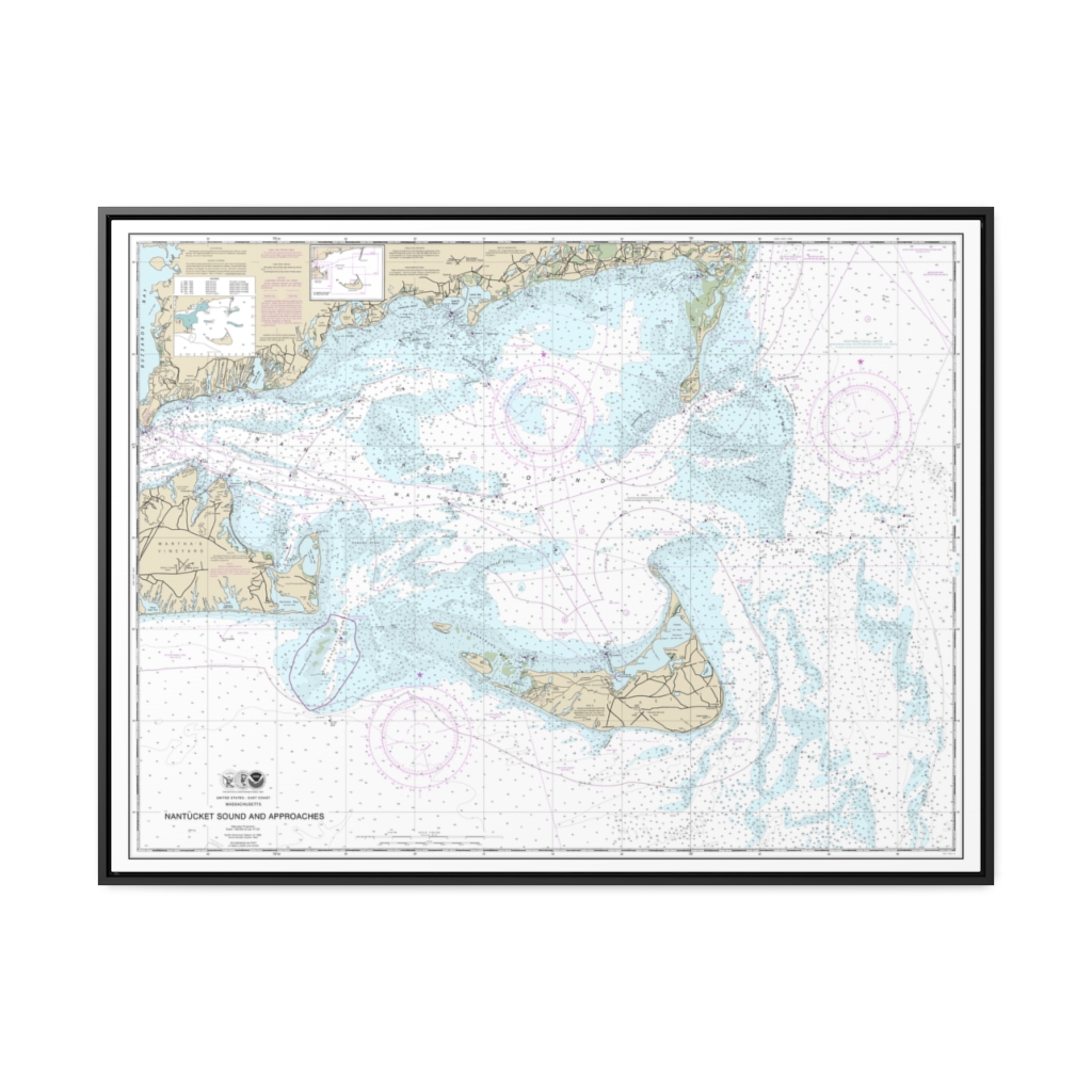
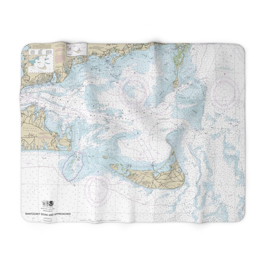
Nantucket Sound and Approaches Nautical Chart 13237 – Floating Frame Canvas
From: $184.95PREMIUM FLOATING FRAME CANVASDistance from your search: 3526.6mi -
Distance from your search: 3527.3mi
-
Distance from your search: 3527.3mi
-
Chesapeake Bay Wolf Trap to Smith Point Nautical Chart 12225 – Floating Frame Canvas
From: $184.95PREMIUM FLOATING FRAME CANVASDistance from your search: 3528.4mi -
Barataria Bay and approaches Nautical Chart 11358 – Floating Frame Canvas
From: $184.95PREMIUM FLOATING FRAME CANVASDistance from your search: 3528.7mi -
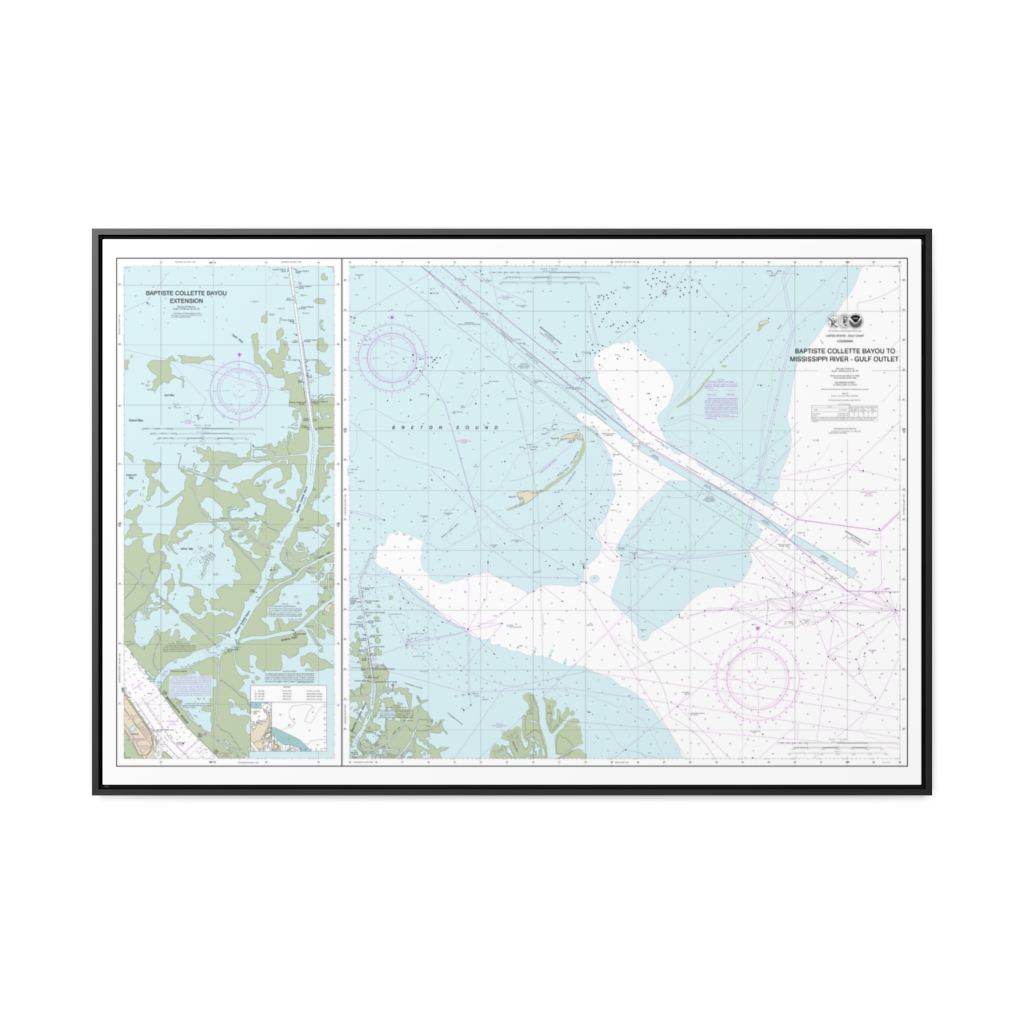
Baptiste Collette Bayou to Mississippi River Gulf Outlet Baptiste Collette Bayou Extension Nautical Chart 11353 – Floating Frame Canvas
From: $164.95PREMIUM FLOATING FRAME CANVASDistance from your search: 3529.1mi -
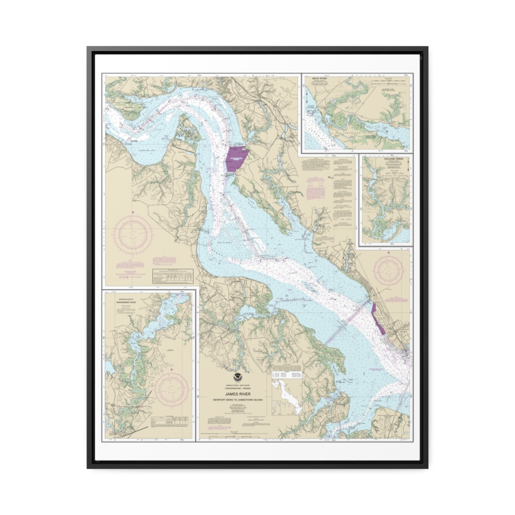
James River Newport News to Jamestown Island; Back River and College Creek Nautical Chart 12248 – Floating Frame Canvas
From: $184.95PREMIUM FLOATING FRAME CANVASDistance from your search: 3530.4mi -
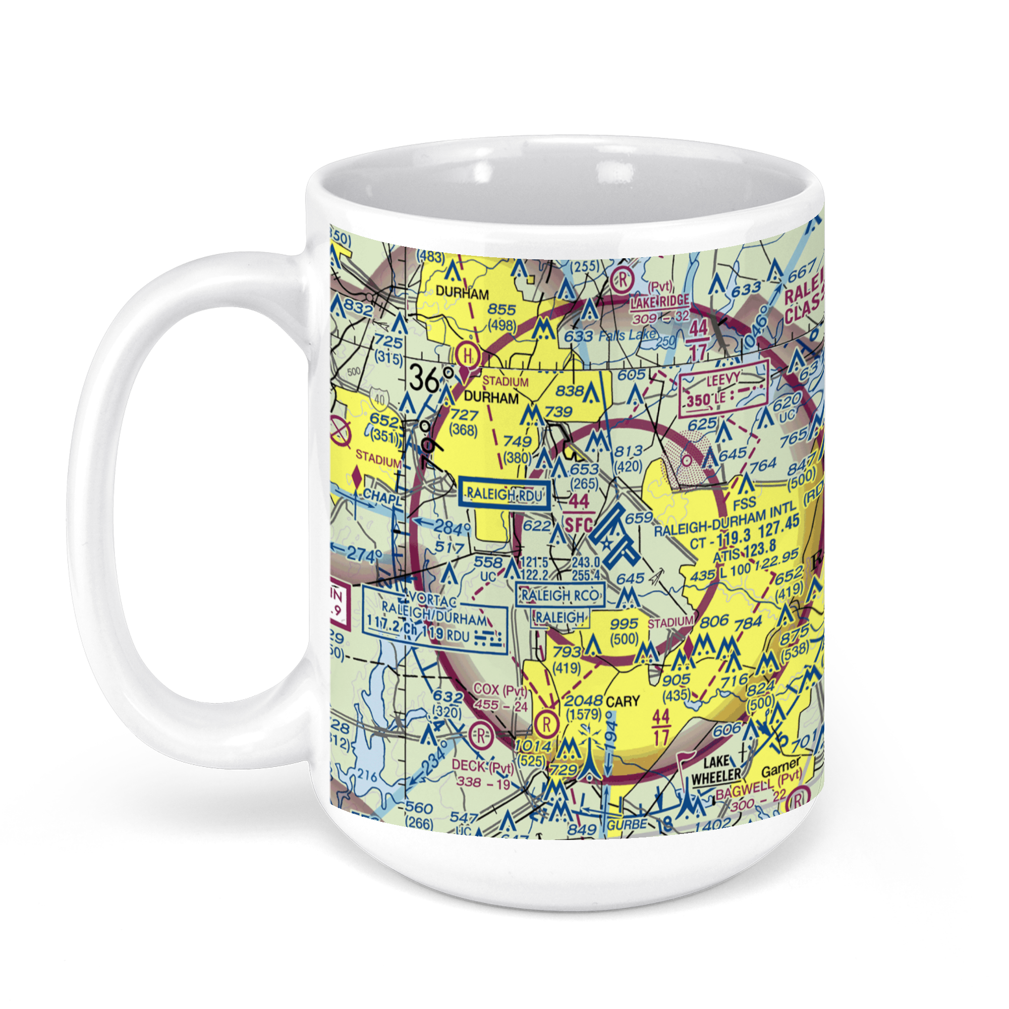 11oz From $14.21 15oz From $16.46
Raleigh-Durham International Airport (RDU), John Brantley Boulevard, Morrisville, NC, USA FAA Sectional Aeronautical Charts Chart Mug
From: $18.95MIX, MATCH & SAVE! UP TO 25% OFFDistance from your search: 3531.1mi -
Eastern Entrance to Nantucket Sound Nautical Chart 13244 – Floating Frame Canvas
From: $184.95PREMIUM FLOATING FRAME CANVASDistance from your search: 3532.2mi